 ">
">
36 East Coast Trails That Aren’t the Appalachian Trail
When it comes to hiking on the east coast, the Appalachian Trail usually gets all the attention. After all, it’s one of the Triple Crown trails, and thousands of people flock to Springer Mountain or Katahdin every year in hopes of becoming 2,000-milers. The AT’s fame is well-deserved.
But it isn’t the only beautiful long-distance trail in the east. While other trails might not be as famous, they certainly have just as much to offer — unique flora, rich history, rugged wilderness areas, and breathtaking scenery — and are probably less crowded than everyone’s favorite white-blazed footpath.
Looking for an east coast adventure on a trail that isn’t the AT? Check out our list of trails below.
Quick Navigation
Alabama |Florida | Georgia | North Carolina | South Carolina | Tennessee
Appalachian High Route (NC)
Bartram Trail (GA, NC)
Benton MacKaye Trail (GA, NC, TN)
Cumberland Trail (TN)
Florida Trail (FL)
Foothills Trail (SC, NC)
Mountains to Sea Trail (NC)
Palmetto Trail (SC)
Ocean to Lake Trail (FL)
Pinhoti Trail (AL, GA)
Sheltowee Trace (KY, TN)
Kentucky | Maryland | Ohio | Pennsylvania | Virginia | West Virginia
Allegheny Trail (WV)
Pine Mountain State Scenic Trail (VA, KY)
Tuscarora Trail (VA, WV, MD, PA)
Baker Trail (PA)
Black Forest Trail (PA)
Chuck Keiper Trail (PA)
Donut Hole Trail (PA)
Laurel Highlands Hiking Trail (PA)
Loyalsock Trail (PA)
Mason-Dixon Trail (PA)
Mid State Trail (PA)
Potomac Heritage Trail (VA, WV, MD, PA)
Quehanna Trail (PA)
Standing Stone Trail (PA)
Susquehannock Trail (PA)
West Rim Trail (PA)
Buckeye Trail (OH)
Connecticut | Maine | Massachussetts |New Hampshire | New York | Vermont
Finger Lakes Trail (NY)
Northville-Placid Trail (NY)
Bay Circuit Trail (MA)
Cohos Trail (NH)
Long Trail (MA, VT)
New England Trail (CT, MA)
Pemi Loop (NH)
Also …
Great Eastern Trail (AL – NY)
Allegheny Trail
Length: 311 miles
Start/End: Mason-Dixon Line, WV / Peters Mountain, WV
The Allegheny Trail is West Virginia’s longest hiking trail. Traversing woodlands, streams, farmlands, and country roads, this north-south trail passes through four state parks, two state forests, two national wilderness areas, and three national forests (Monongahela, George Washington, and Jefferson). Currently, a 20- to 30-mile section of the trail called “the gap” remains unfinished, though the West Virginia Scenic Trails Association is making efforts to complete it.
Appalachian High Route
Length: 330 miles
Start/End: Burnsville, NC

Photo credit: Katie “Oats” Houston
The Appalachian High Route is a 330-mile loop that links the AT, Black Mountain Crest Trail, Mountains to Sea Trail, and the Burnsville Connector to create an east coast “peak-bagger’s dream.” Pioneered by Jennifer Pharr Davis, the route passes iconic landmarks like Mount Mitchell and Max Patch and provides access to nearly all of the 6,000-foot peaks east of the Mississippi.
READ NEXT —
- Trail Profile: The Appalachian High Route
- Jennifer Pharr Davis’s 350-Mile Appalachian High Route is a Peak Bagger’s Dream
Baker Trail
Length: 134 miles (217 kilometers)
Start/End: Freeport, PA / Marienville, PA
Located in western Pennsylvania, the Baker Trail was established in 1950 and named for the late Pittsburgh attorney Horace Forbes Baker. It is one of 18 state-designated hiking trails in Pennsylvania. It follows forest paths, old jeep trails, paved roads and dirt roads through woods, farmlands, and along rivers and creeks. You can sleep at any of nine campsites with open-front shelters located on side paths along the Baker Trail, along with primitive campsites where tents can be used.
Bartram Trail
Length: 116 miles (187 kilometers)
Start/End: Russell Bridge, GA / Cheoah Bald, NC
Named for 18th-century explorer, naturalist, and writer William Bartram, the Bartram Trail winds its way through some of the most scenic mountains in Georgia and North Carolina, following the path Bartram took during his explorations of the south. Featuring rhododendron forests, sleepy hollows, impressive waterfalls, and spectacular lookouts, the trail provides a less-traveled alternative to the Appalachian Trail through some of the most beautiful scenery in the area.
Bay Circuit Trail
Length: 230 miles (370 kilometers)
Start/End: Merrimack River, MA / Kingston Bay, MA
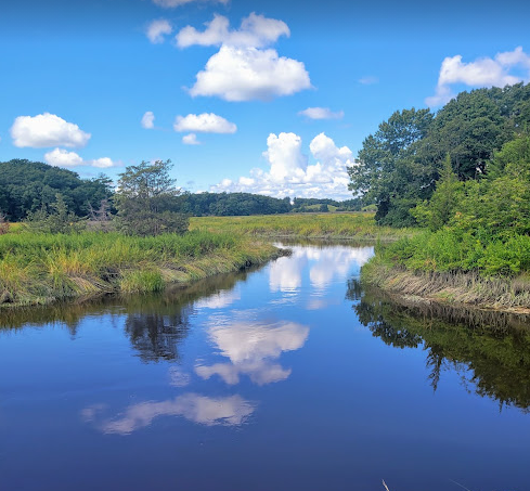
Photo: Lyla Harrod
The Bay Circuit Trail extends through 37 towns in Eastern Massachusetts, linking parks and open space from the north shore to the south shore of Massachusetts. “The BCT is likely different from any other long-distance hikes you’ve done before,” writes travel blogger New England Waterfalls. “It’s less about the views and iconic destinations, and more about quiet conservation areas, local history, and appealing suburban neighborhoods. There are some lovely views and interesting destinations along the way too, of course.”
READ NEXT — Bay Circuit Trail: Thru-Hiking Boston’s Emerald Necklace
Benton MacKaye Trail
Length: 285 miles (459 kilometers)
Start/End: Springer Mountain, GA / Big Creek, NC

Photo credit: Sara Leibold
Known for its remoteness, the Benton MacKaye Trail (BMT) is a prime opportunity for peace and solitude. It starts on Springer Mountain and shares its first seven miles with the AT before veering west toward amazing ridgeline views and many mountain stream crossings.
According to the Benton MacKaye Trail Association, “The BMT has some of the most varied and abundant wildflowers of any temperate climate forest in the world. Whether it’s the creek-side trilliums in the spring, the red-orange of the fall sugar maples at the higher elevations, or the unmatched 360-degree views in the winter, the BMT is a visual treat any time of the year.”
READ NEXT — How to Hike The Benton MacKaye Trail
Black Forest Trail
Length: 43 miles (69 kilometers)
Start/End: Slate Run, PA

Photo credit: Troy Zohner
Considered one of the most challenging and rewarding backpacking trails in Pennsylvania, the Black Forest Trail is a spectacular long-distance loop that leads through and above the west side of Pine Creek Gorge in the northwest corner of Lycoming County. It dips in and out of the chasm several times, with very steep ascents and descents, before leveling out on top of the plateau. The trail gets its name from the hemlock trees that once grew so thick that sunlight couldn’t reach the forest floor.
READ NEXT — The Black Forest Trail: 43 Miles of Pennsylvania’s Beautiful Forests
Buckeye Trail
Length: 1,444 miles (2,324 kilometers)
Start/End: Loop trail encompassing Ohio

Photo: Wormwould on Flickr
The Buckeye Trail is a 1,444-mile loop that reaches into every corner of Ohio, offering hikers a varied — yet relatively accessible — experience.
“In some sections, you’ll be hiking along a lake for over 20 miles. In others, you’ll pass multiple waterfalls and swimming holes.”Covered bridges? Check. Rolling hills? Check. Friendly trail towns? Check,” writes Trek blogger Yard Sale. ” One thing you won’t find on the Buckeye Trail,” she continues, “are brutal peaks… the elevation gain is blessedly nominal throughout most of the trail’s length.”
READ NEXT — How to Travel Around Ohio: The 1,444-Mile Buckeye Trail
Chuck Keiper Trail
Length: 47 miles (76 kilometers)
Start/End: Sproul State Forest, PA

Photo credit: Nicholas A. Tonelli
The Chuck Keiper Trail visits some of the wildest and most scenic public lands in Pennsylvania. It’s “named after Charles F. Keiper who was a dedicated conservationist and wildlife law enforcement officer,” according to PA Hikes. The trail consists of two loops within Sproul State Forest.
Cohos Trail
Length: 170 miles (274 kilometers)
Start/End: Crawford Notch, NH / Pittsburg, NH

Photo: Erica Notini
The Cohos Trail runs from southern Crawford Notch in White Mountain National Forest through the Great North Woods to the Canadian border at Pittsburg, NH. It encompasses nearly 40 peaks, including some of the tallest in the northeast, and reaches New Hampshire’s highest cliffs. On this trail you’ll experience three major river watersheds, numerous waterfalls and major wildlife bogs and marshes, and a million acres of forest.
On the Cohos Trail, you will hike through many diverse northern New England ecosystems, from dark spruce forests and bogs to beautiful wildflower meadows on open mountain slopes.
READ NEXT: The Cohos Trail: 170 Miles of New Hampshire’s North Woods
Cumberland Trail
Length: 300 miles (483 kilometers)
Start/End: Signal Mountain, TN / Cumberland Gap, TN
The Cumberland Trail follows a line of pristine high ridges and deep gorges lying along Tennessee’s Cumberland Plateau, linking State Park lands, State Natural Areas, Wildlife Management Areas, and National Parks.
According to Chattanooga Tourism, “the Cumberland Trail is one of the best ways to see some of the most rugged and remote terrain that Tennessee has to offer. Running along the eastern side of the state, south from Cumberland Gap on the Kentucky line to within sight of Georgia, the Cumberland Trail itself is part of the even more ambitious Great Eastern Trail.”
Donut Hole Trail
Length: 94 miles (151 kilometers)
Start/End: Jericho, PA / Farrandsville, PA
The Donut Hole Trail is one of the most remote and challenging of Pennsylvania’s backpacking trails, with numerous steep climbs, unbridged stream crossings, and long stretches that are far from civilization. It follows the Susquehanna River and passes through Sproul State Forest amidst some of the thickest wooded areas in Pennsylvania.
Finger Lakes Trail
Length: 580 miles (933 kilometers)
Start/End: Allegany State Park, NY / Slide Mountain, NY
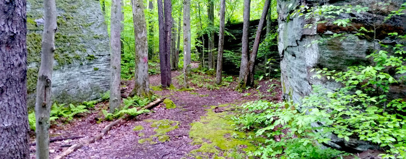
Photo: Kim
The Finger Lakes Trail (FLT) shares its route with the North Country National Scenic Trail for over 400 miles, passing dramatic, glacier-formed ridges with scenic views of the Finger Lakes, deep verdant valleys, secluded glens, and many waterfalls, touching the south ends of the Finger Lakes. Along with the main trail, six branch trails and 29 loop and spur trails create the Finger Lakes Trail System, which offers 1,000 miles of hiking.
Florida Trail
Length: 1,100 miles (1,770 kilometers)
Start/End: Big Cypress National Preserve, FL / Fort Pickens, FL

Photo credit: Owen Eigenbrot
Designated as the country’s eighth National Scenic Trail in 1983, the Florida Trail is an ecologically diverse adventure from one end of Florida to the other, traversing prairies, swamps, sandhills, salt marshes, pine forests, rivers, beaches, and so much more. The trail is best hiked between October and April, making it one of the few US trails that are traditionally hiked in winter. Over its length, it showcases the incredible biodiversity, history, and rich culture of Florida.
And yes, there are alligators.
READ NEXT — 11 Reasons the Florida Trail is Awesome
Foothills Trail
Length: 77 miles (124 kilometers)
Start/End: Oconee State Park, SC / Table Rock State Park, NC

Photo credit: Clay Bonnyman Evans
“The Foothills Trail winds through a scenic and diverse landscape,” writes Laura A. Garren in South Carolina Wildlife, “deep mountain hollows rarely visited by the sun; ridges offering stunning views of the Blue Ridge Mountains; sun-flecked glens that look like they should harbor hobbits; rushing streams that cascade over rocks and transform into waterfalls.”
Rated as one of the best long trails in the country by Backpacker Magazine, the Foothills Trail is a walk through history, featuring structures and equipment left behind by pioneering settlers; it’s also a walk through unique geological and botanical features, including plants rarely found elsewhere in the world.
READ NEXT — The Foothills Trail: 77 Miles Through South and North Carolina
Great Eastern Trail
Length: 1800 miles (2897 kilometers; incomplete)
Start/End: Conecuh National Forest, AL / Moss Hill Lean-To, NY
The Great Eastern Trail is an as-yet incomplete long-distance footpath linking many existing trails from Alabama to New York. Once complete, its length will rival that of the AT situated slightly to the east, providing one possible alternative for east coast hikers seeking a very long walk in the woods.
The GET intersects the Florida Trail in the south and the North Country Trail in the north, providing interesting options for those who want an even longer trek.
Laurel Hills Hiking Trail
Length: 70 miles
Start/End: Seward, PA / Ohiopyle State Park, PA
The Laurel Highlands Hiking Trail is part of the Potomac Heritage National Scenic Trail network. It follows Laurel Ridge through hemlock groves, mountain streams, and hardwood forests. This trail has plenty to offer year-round, with abundant wildflowers in the spring and spectacular views in the winter. Cross-country skiing, snowshoeing, and winter backpacking are popular activities.
Long Trail
Length: 272 miles
Start/End: Williamstown, MA / Journey’s End Road, VT

Photo credit: Julia Gladstein
Spanning the length of Vermont, the Long Trail is the oldest continuous footpath in the US and provided the inspiration for the Appalachian Trail. Called the “footpath in the wilderness,” this trail follows the main ridge of the Green Mountains and is certainly challenging with its steep climbs and muddy sections. However, it’s also a beautiful journey through hardwood forests and alpine sedges with clear ponds and streams along the way.
Loyalsock Trail
Length: 59 miles (95 kilometers)
Start/End: PA-87, Williamsport, PA / Mead Rd., Dushore, PA

Photo credit: Brian Cipperly
Known for its beautiful vistas, the Loyalsock Trail climbs up and down ridges and mountaintops, passing many waterfalls, lakes, ponds, and historic places. Most of the trail is located within the Loyalsock State Forest, with the remainder on private land.
It passes many points of interest: Allegheny Ridge, Helen’s Window, Smith’s Knob, Angel Falls, Kettle Creek Vista, Dutter Run Falls, Mary’s View, High Knob, Lee’s and Rode Falls in Ketchum Run Gorge, Alpine Views, Mineral Spring, Loyalsock Canyon Vista, Worlds End State Park, High Rock Vista, Alpine Falls, Sones Pond, The Haystacks, and Dutchman Falls.
READ NEXT — Pennsylvania’s Loyalsock Trail: a Thru-Hiking Guide
Mason-Dixon Trail
Length: 193 miles (311 kilometers)
Start/End: Chadds Ford, PA / Whiskey Springs on the Appalachian Trail, PA
The Mason-Dixon Trail connects the Appalachian Trail with the Brandywine Trail. Following backroads in Delaware and Maryland, the trail passes beautiful old homes, farms, and rural scenery. A 30-mile stretch of the trail between Wrightsville and Norman Wood Bridge is designated as a National Recreation Trail, and this area is especially scenic, with opportunities to experience the area’s flora, fauna, unique geology, and historic points of interest.
Mid State Trail
Length: 323 miles (518 kilometers)
Start/End: Mason-Dixon Line, PA / North of Cowanesque Lake, PA

Photo credit: Yard Sale
Known as the longest and wildest trail in Pennsylvania, the Mid State Trail is a rugged and challenging hike along rocky ridges, roads and railroad grades, creeks and rivers, and miles of thick forest. The trail is broken into four sections, each with its own unique features, landscape, and geology.
The Keystone Trails Association notes that “the rocky ridges and thick forests provide an illusion of remoteness and solitude that is surprising for the second most industrialized state in the nation.”
Mountains to Sea Trail
Length: 1,175 miles
Start/End: Clingman’s Dome, NC / Jockey’s Ridge State Park, NC

Photo credit: Sprout
The Mountains to Sea Trail stretches across North Carolina, connecting the Great Smoky Mountains to the Outer Banks. Friends of the Mountains-to-Sea Trail writes that “along the trail, you may see mountain vistas, rolling Piedmont farms, picture postcard colonial towns, weathered tobacco barns, old textile villages, country churches, rushing mountain streams, coastal swamps, hardwood and pine forests, lighthouses, sand dunes, miles of seashore, and friendly people.”
Currently, 725 miles of the trail are complete with roads connecting the rest. For those who enjoy being on the water, there is an optional paddle route as well.
READ NEXT —
- An Overview of North Carolina’s 1,150 Mile Mountains to Sea Trail
- 10 Undeniable Truths of North Carolina’s Mountains-to-Sea Trail
New England Trail
Length: 235 miles
Start/End: Chittenden Park, CT / Royalston, MA
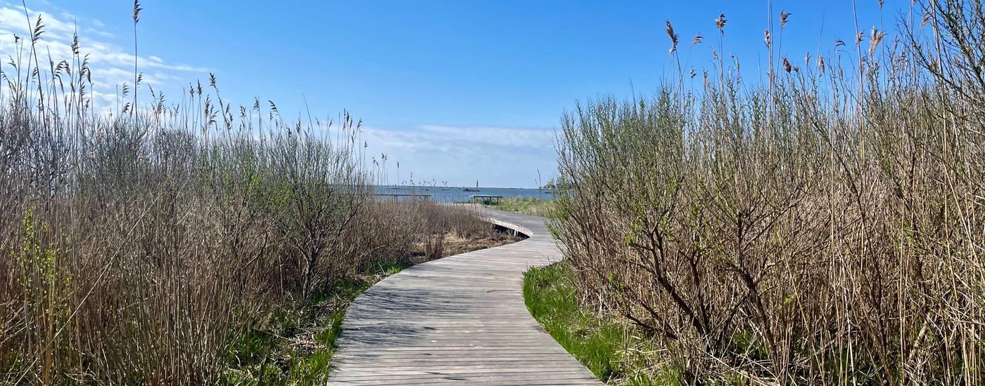
Photo: Trishadee Newlin
The New England Trail travels through 41 communities in Connecticut and Massachusetts and is comprised primarily of the historic Mattabesett, Metacomet, and Monadnock Trail systems. According to the NET’s official website, this national scenic trail features “long-distance vistas with rural towns as a backdrop, agrarian lands, unfragmented forests, and large river valleys. The trail also travels through colonial historical landmarks and highlights a range of diverse ecosystems and natural resources: mountain ridges and summits, forested glades, wetlands and vernal pools, lakes, streams, and waterfalls.”
Northville-Placid Trail
Length: 135 miles (217 kilometers)
Start/End: Northville, NY / Lake Placid, NY

Photo: Rachel Welch
The Northville-Placid Trail runs through some of the most remote areas of the Adirondack Park, making its way through forests and up hills and around rivers and ponds. The scenery changes constantly, and hiking the trail is a wonderful way to experience the beauty of the Adirondacks. The Adirondack Mountain Club’s Schenectady Chapter calls this trail “one of the most interesting and perhaps least known features of the Adirondack Mountains region.”
READ NEXT — The Northville-Placid Trail: A 133-Mile Hidden Gem in the Adirondacks
Ocean to Lake Trail
Length: 61 miles (98 kilometers)
Start/End: Hobe Sound Beach, FL / Lake Okeechobee, FL

Photo credit: Amanda Genovese
If you’d like to backpack in Florida but prefer a shorter adventure than the Florida Trail, look no further than the Ocean to Lake Hiking Trail, which is located near Jupiter on the eastern coast. Considered one of the more beautiful and difficult backpacking routes in South Florida, it travels through the North Everglades Natural Area, where the ecosystems on the trail change approximately every mile.
From ancient sand dunes with scrub oak and sand pine to pine flat woods, palmetto and oak hammocks, cypress swamp and wet prairies, this trail has a lot to offer.
READ NEXT — Getting Our Feet Wet on the Ocean to Lake Trail
Palmetto Trail
Length: 500 miles (not yet complete)
Start/End: Walhalla, SC / Awendaw, SC
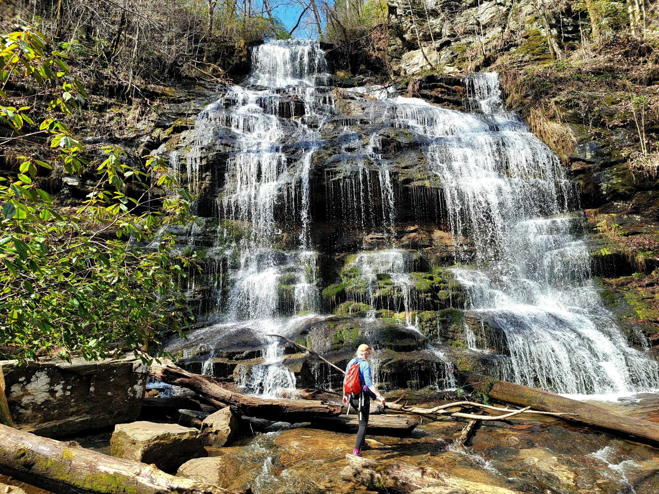
Photo: Mav
The Palmetto Trail is South Carolina’s longest pedestrian and bicycle trail and largest trail construction project. It comprises 500 miles (380 miles currently complete) of hiking and bicycling paths connecting the mountains of South Carolina to the seacoast. It travels beside lakes, across mountain ridges, through forests, into towns big and small, and across swamps.
Pemi Loop
Length: 31.5 miles
Start/End: Lincoln Woods Visitor Center, NH

Photo credit: Kayla Pedersen
The Pemi Loop encircles the western half of the Pemigewasset Wilderness and climbs over eight of New Hampshire’s 48 4,000-foot peaks. Hikers can expect plenty of rock scrambling and steep climbs, but the stunning vistas make the effort well worth it.
Backpacker Magazine named it the second hardest day hike in America, but splitting the Pemi Loop into a two- or three-day backpacking trip makes the hike more manageable.
READ NEXT — Backpacking the Semi-Pemi 2019
Pine Mountain State Scenic Trail
Length: 120 miles
Start/End: Breaks Interstate Park, VA / Cumberland Gap National Historic Park, KY
“The Pine Mountain Trail is still under development and will span 120 miles,” according to FarOut. “The trail runs along the sawtooth spine of Pine Mountain on the border between Kentucky and Virginia. The mountain is known for its colorful moonshine and post-Civil War feud history, for the spectacular views across the Cumberland Plateau, the diversity of plant and animal life, and interesting geological features (waterfalls, arches, rockshelters, cliffs, gorges and bogs). The trail has a very healthy black bear population. Unlike other trails that are over-loved, this is a newer trail and a hidden gem.”
Pinhoti Trail
Length: 350 miles (563 kilometers)
Start/End: Southern Terminus: Flagg Mountain, AL / Northern Terminus: Benton MacKaye Trail, GA

Photo: Spiderwort
The Pinhoti Trail stretches from Flagg Mountain in Alabama to the Benton MacKaye Trail in Georgia. Completed in 2008, the trail includes quite a bit of road walking; even so, there is plenty to see.
It’s said that the Pinhoti has two distinct personalities: the section from Flagg Mountain to Cheaha State Park, which offers green tunnels and gentle grades, and the section from Cheaha to the northern terminus, which is steeper, has more water crossings, and offers more expansive views.
Potomac Heritage Trail
Length: 425 miles
Start/End: Point Lookout State Park, MD / Johnstown, PA

Photo: Beans
Following paths explored by George Washington, the Potomac Heritage National Scenic Trail (PHT) runs from the mouth of the Potomac River in Maryland and Virginia to the Alleghany Highlands in western Pennsylvania.
Unlike many other trails, such as the Appalachian Trail or Pacific Crest Trail, the PHT is an informal route with numerous side trails and alternatives that provide a “choose-your-own-adventure” style thru-hike. The trail network includes roughly 830 miles of existing and planned sections offering opportunities for hiking, biking, paddling, horseback riding, and cross-country skiing.
READ NEXT — Potomac Heritage Trail Thru-Hike (If you want to thru-hike the PHT, here is some info to get you started!)
Quehanna Trail
Length: 74 miles (119 kilometers)
Start/End: Parker Dam State Park, PA
The Quehanna Trail makes a loop through Moshannon and Elk state forests. The southern part of the Quehanna Plateau is a mostly oak-laurel ecosystem, while the northern part is characterized by northern hardwoods mixed with hemlock and pine.
Part of the trail passes through the largest wild area in the state, the Quehanna Wild Area, which is known for its beautiful streams and unusual open savannas.
Sheltowee Trace
Length: 343 miles
Start/End: On KY377 near Morehead, KY / Pickett State Park, TN

Photo credit: Jim Rahtz
The Sheltowee Trace National Recreation Trail is considered the “backbone” of the Daniel Boone National Forest’s trail system. It passes through many scenic areas such as Cave Run Lake, Red River Gorge, Natural Bridge State Park, Laurel Lake, Cumberland Falls State Park, and the Big South Fork Recreation Area.
Modeled after the growing popularity of the Appalachian Trail, the Trace was designed by Forest Service employee Verne Orndorff to give users an opportunity to backpack the entire length of the Daniel Boone National Forest.
READ NEXT — Hike the Sheltowee Trace: Kentucky’s 323-Mile Long Trail
Standing Stone Trail
Length: 85 miles
Start/End: Cowans Gap State Park, PA / Mid State Trail in the Detweiler Run Natural Area, PA
The Standing Stone Trail connects the Tuscarora Trail in the South to the Mid State Trail in the North and is part of the larger Great Eastern Trail. Running through the heart of the ridge and valley section of the Appalachian Range, the trail passes through Cowans Gap State Park, Rocky Ridge Natural Area, Greenwood Furnace State Park, Alan Seeger Natural Area, and Detweiler Run Natural Area.
Susquehannock Trail
Length: 84 miles
Start/End: Northern Gateways Trailhead, Potter County, PA

Photo credit: Troy Zohner
The Susquehannock Trail System (STS) is an 84-mile loop linking 63 separate trails, most of which are old Civilian Conservation Corps fire trails. With ten trailheads to choose from, the STS can be broken into day hikes by those looking for a shorter adventure.
The most secluded section of the STS is a 10-mile stretch through Pennsylvania’s largest wild area, the Hammersley Wild Area, offering hikers access to part of the most remote and pristine nature Pennsylvania has to offer.
READ NEXT — Trail Profile: Backpacking PA’s Susquehannock Trail System
Tuscarora Trail
Length: 250 miles (402 kilometers)
Start/End: Shenandoah National Park, VA / Appalachian Trail on Blue Mountain, PA
Established in the 1960s as an alternate route for the Appalachian Trail (AT), the Tuscarora Trail travels through four states: Virginia, West Virginia, Maryland, and Pennsylvania.
The Tuscarora Trail leaves the AT near Mathews Arm Campground in Shenandoah National Park and makes its way west and north to rejoin the AT atop Blue Mountain. If the AT had not received protection under the National Scenic Trails Act of 1968, the Tuscarora would likely have become the new AT route starting in northern Virginia.
West Rim Trail
Length: 30 miles (48 kilometers)
Start/End: Ansonia, PA / Blackwell, PA
The West Rim Trail follows the edge of Pine Creek Gorge, also known as the Grand Canyon of Pennsylvania. The trail passes through stands of mixed hardwoods, winds along ridges of oak forest with abundant mountain laurel, crosses boggy meadows near beaver dams, and features outstanding vistas as you peer into the gorge and Pine Creek below.
What are some other East Coast trails you enjoy?
Featured image: Graphic design by Zack Goldmann. Background photo via Troy Zohner; center left photo via Sara Leibold; bottom right photo via Owen Eigenbrot.

This website contains affiliate links, which means The Trek may receive a percentage of any product or service you purchase using the links in the articles or advertisements. The buyer pays the same price as they would otherwise, and your purchase helps to support The Trek's ongoing goal to serve you quality backpacking advice and information. Thanks for your support!
To learn more, please visit the About This Site page.

Comments 4
Other than at low-level camping areas along the Glady Fork, and the small sections of road south of Blackwater Falls State Park (in, say, Watoga & Cass SPs), you are unlikely to see another soul on the trail until you hit Interstate-64 (where “The Gap” begins if heading south). Very quiet and beautiful – Shaver’s Mtn is an exquisite forested ridgeline…
My previous comment is concerning the Allegheny Trail in West Virginia!
Many thanks for compiling this excellent list of longer trails!
Firefly, Lots of info here, Thank You!
From another dog lover 🙂
Re. the Pemi Loop: “Backpacker Magazine named it the second hardest day hike in America, but splitting the Pemi Loop into a two- or three-day backpacking trip makes the hike more manageable.” Or, for an old fart like me, a 4.5-day/4 night hike. Did the trail counterclockwise in August a few years ago in my mid-60s. I came across other hikers who were doing it in three days, and a runner who was training to prepare an attempt to do the whole thing in 24 hours or less. To each one’s own.
I’ve seen other trail write-ups over-dramatize the difficulty of this hike. Short bits of the trail are sketchy, but anyone with some experience and a modicum of conditioning shouldn’t have a problem.